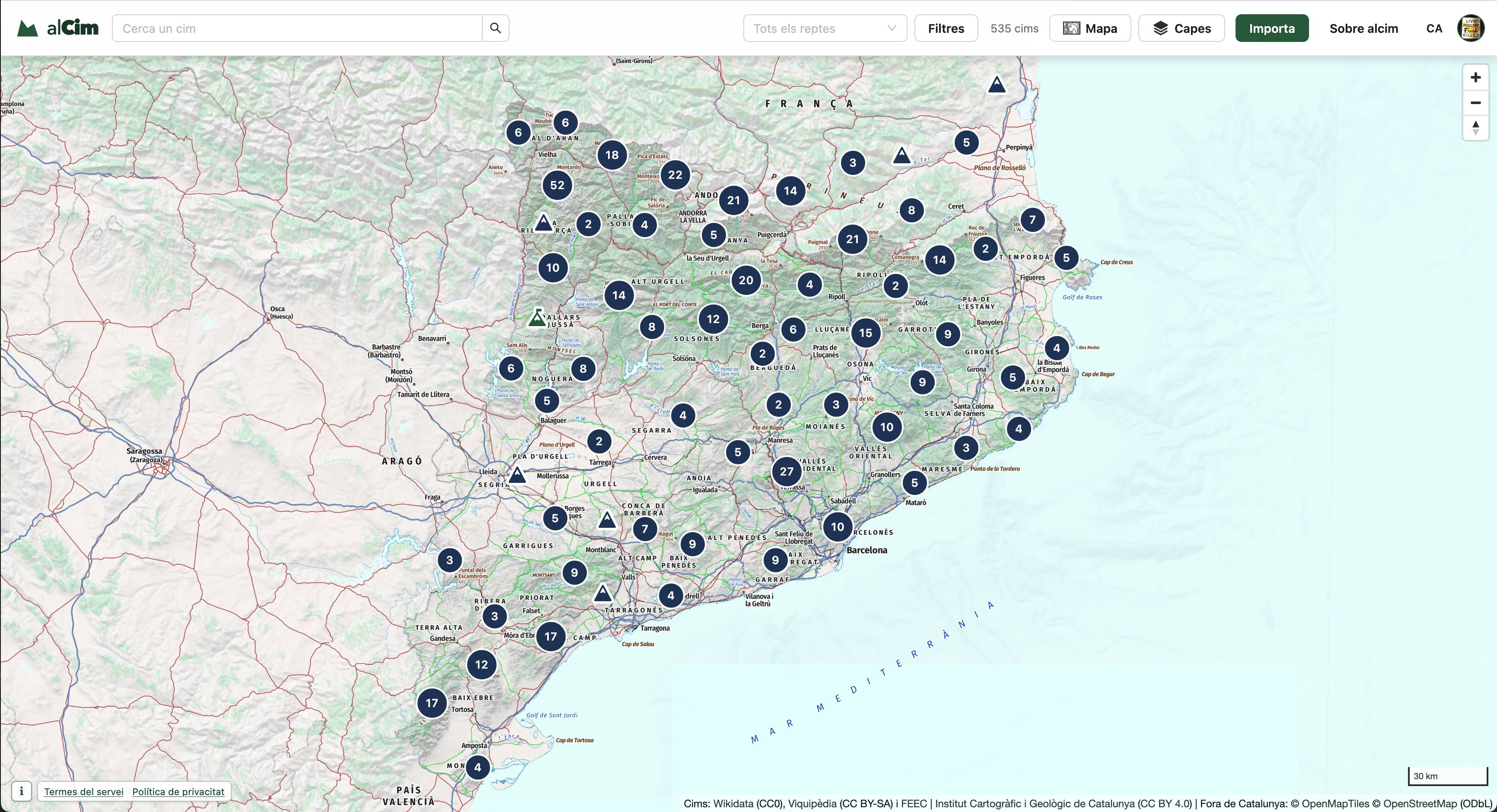
alcim is a map-based web app for people who enjoy the mountains. It brings together discovering peaks, keeping track of the ones you have climbed, following challenges such as 100 Cims, and planning your next route.
Peaks and challenges
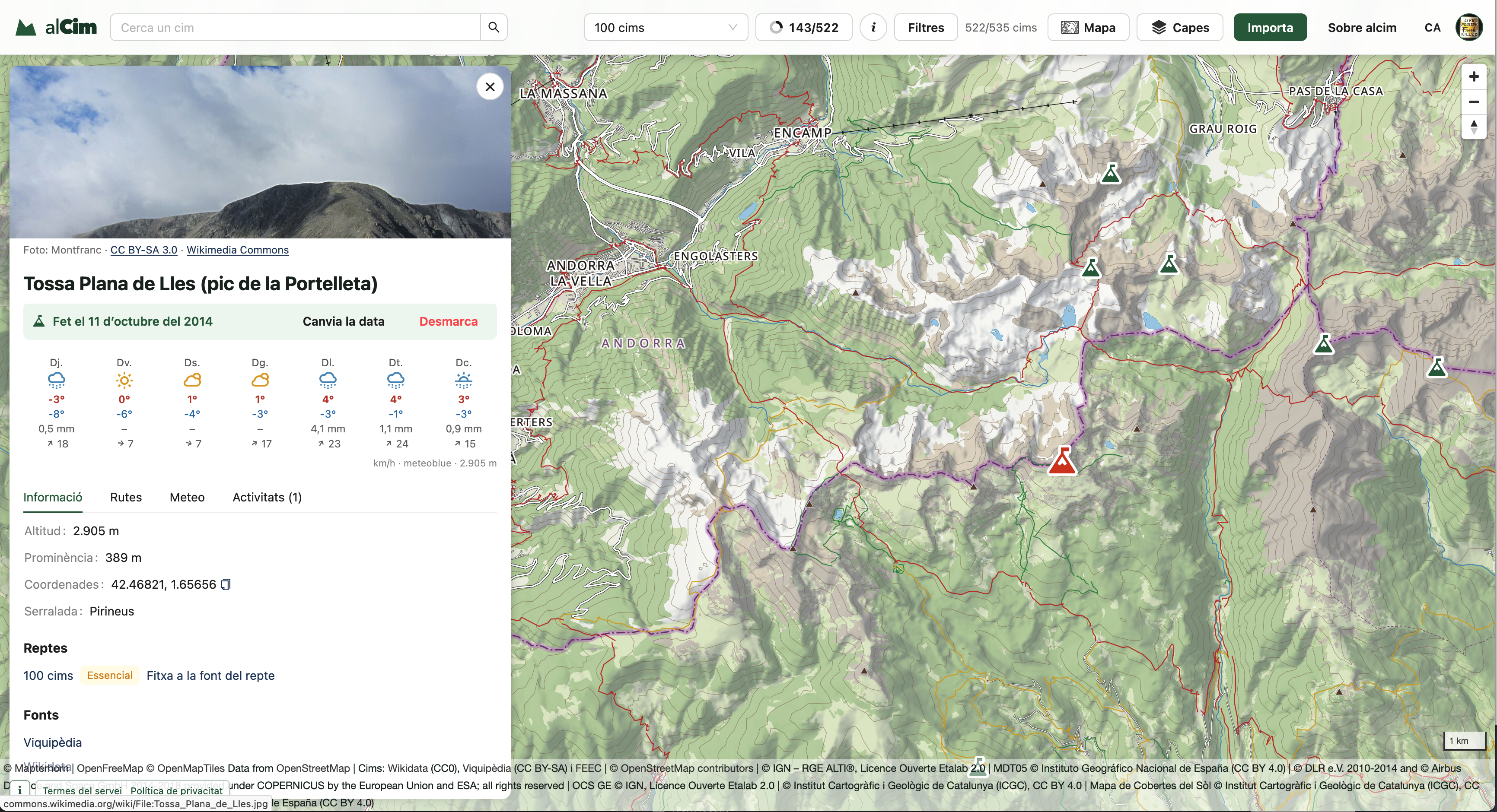
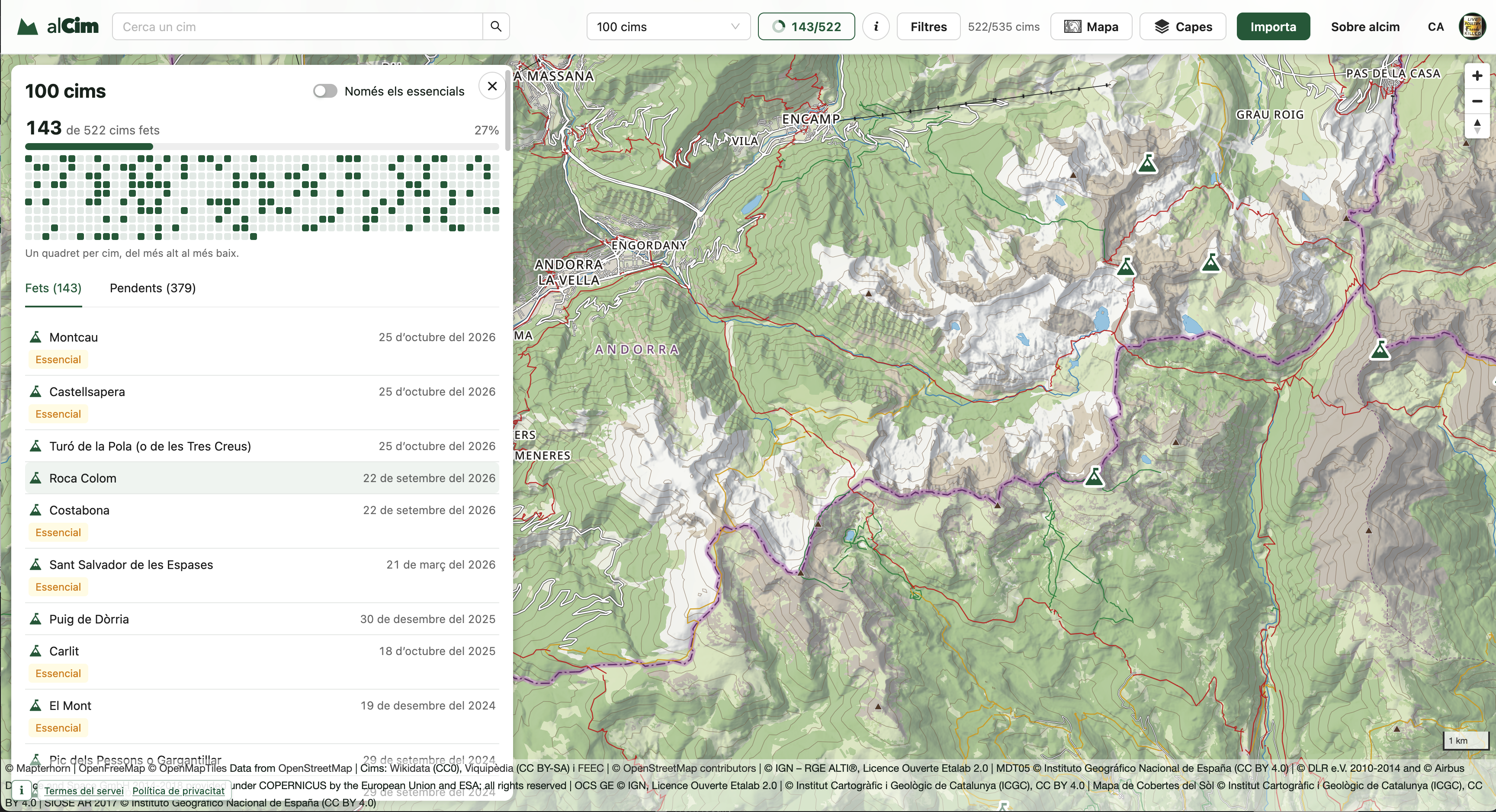
You can explore and filter peaks on the map, open a detailed profile for each one, check the mountain forecast, and record when you reached the summit. Challenges turn a list of peaks into a progress tracker, so it is easy to see what you have done and what is still waiting.
Routes, from idea to GPX
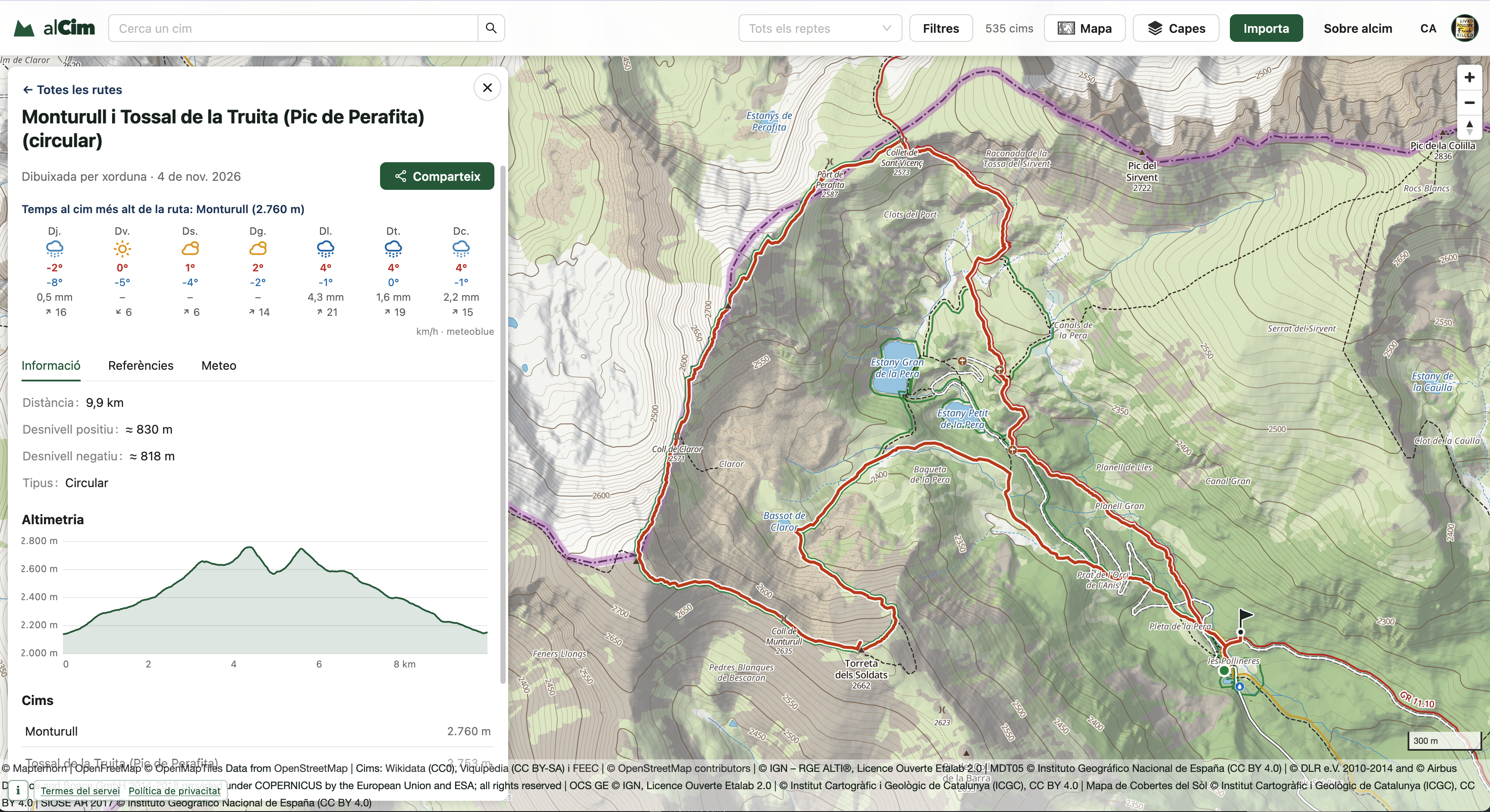
Routes can be imported or drawn directly on the map. The editor follows paths and analyses distance, elevation gain, estimated duration, terrain, and slope, highlighting the sections that deserve extra attention. Finished routes can be saved, shared, and exported as GPX files.
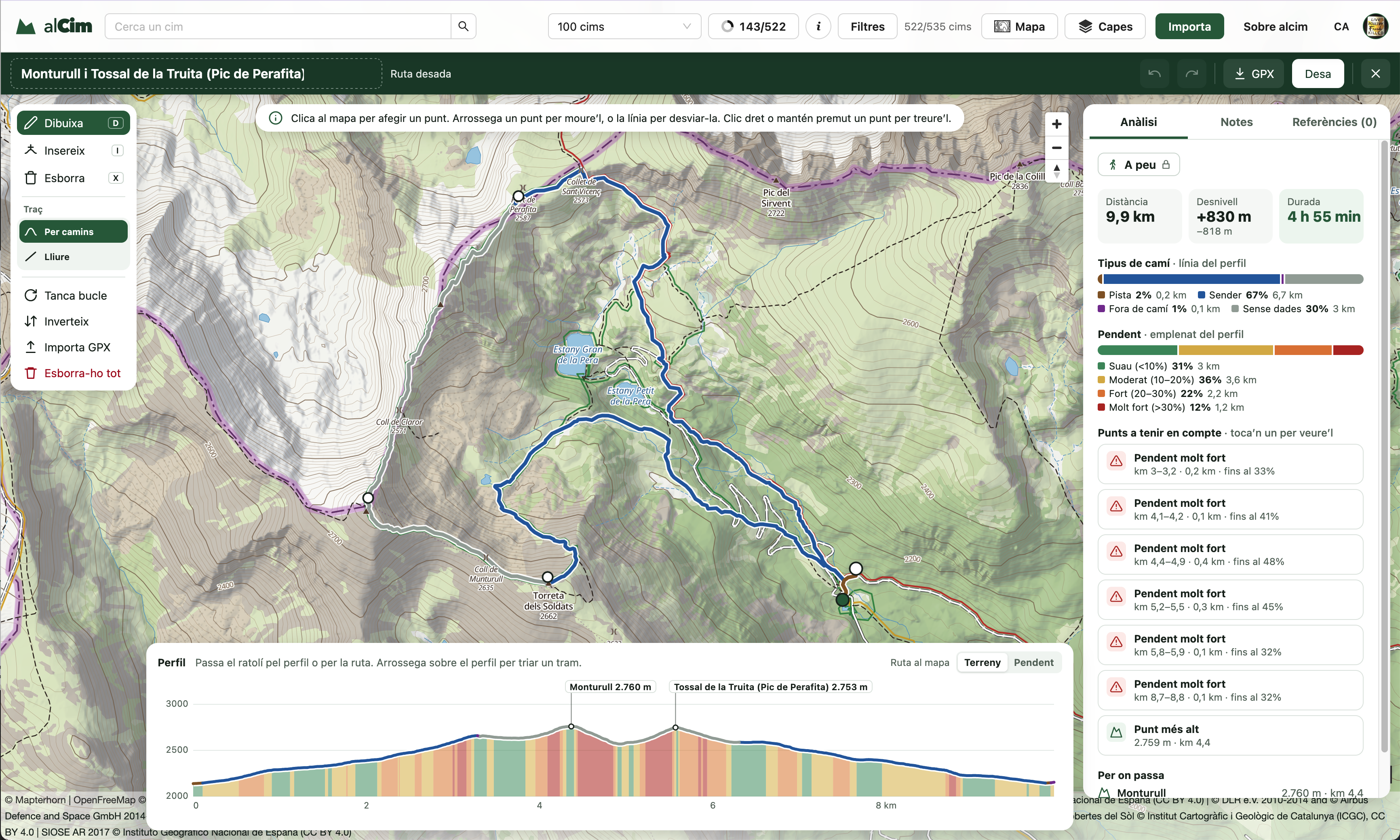
Each route brings the track, elevation profile, peaks along the way, and a forecast for its highest point into one view.
More than one view of the mountain
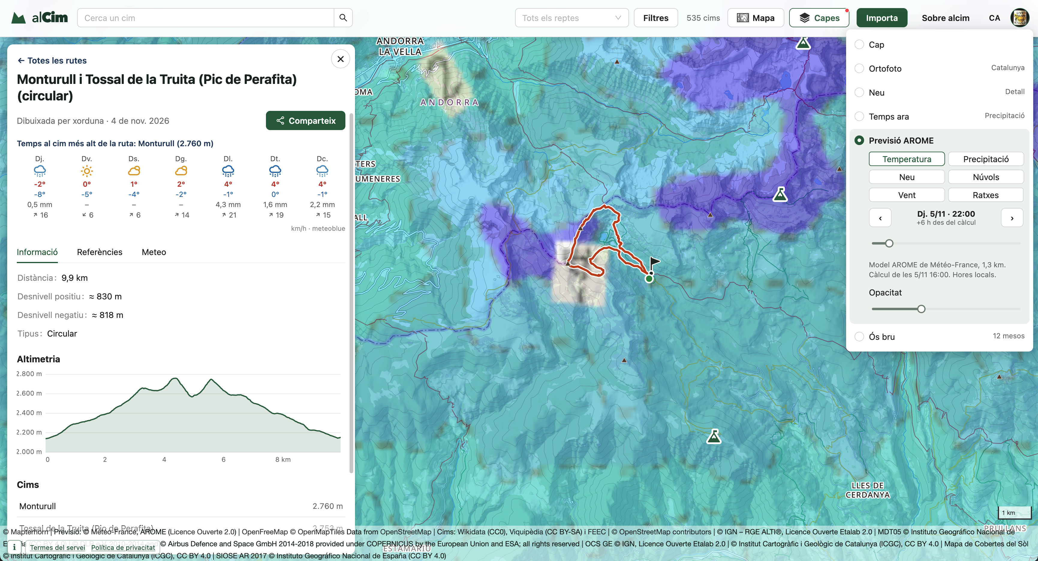
Map layers include aerial imagery and weather forecasts for temperature, precipitation, snow, clouds, wind, and gusts, making it possible to inspect the same route from different angles.
Stack
The backend is written in Go, the interface in React, and the geographic data lives in PostgreSQL + PostGIS. Maps are rendered with MapLibre using the mcarto cartography.